
Unlocking the Untapped Potential of the Langkasuka Basin
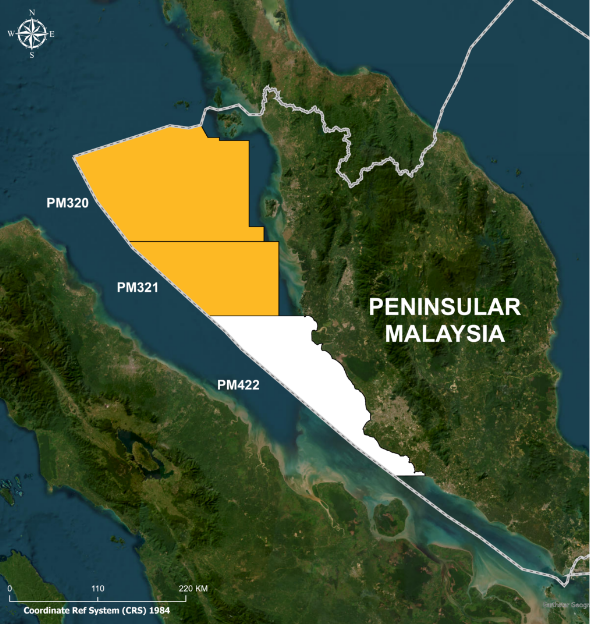
Langkasuka Basin, was named after the ancient kingdom in the Malay Peninsula coined to refer to the Pre-Tertiary sedimentary basin underlying Selat Melaka, Malaysia. It comprises of 3 blocks named PM320, PM321 and PM422. The Langkasuka Basin covers an area of 759,000 km2 wide area encompassing parts of Northwest Sumatra in Indonesia, Western Peninsular Malaysia as well as Peninsular Thailand.
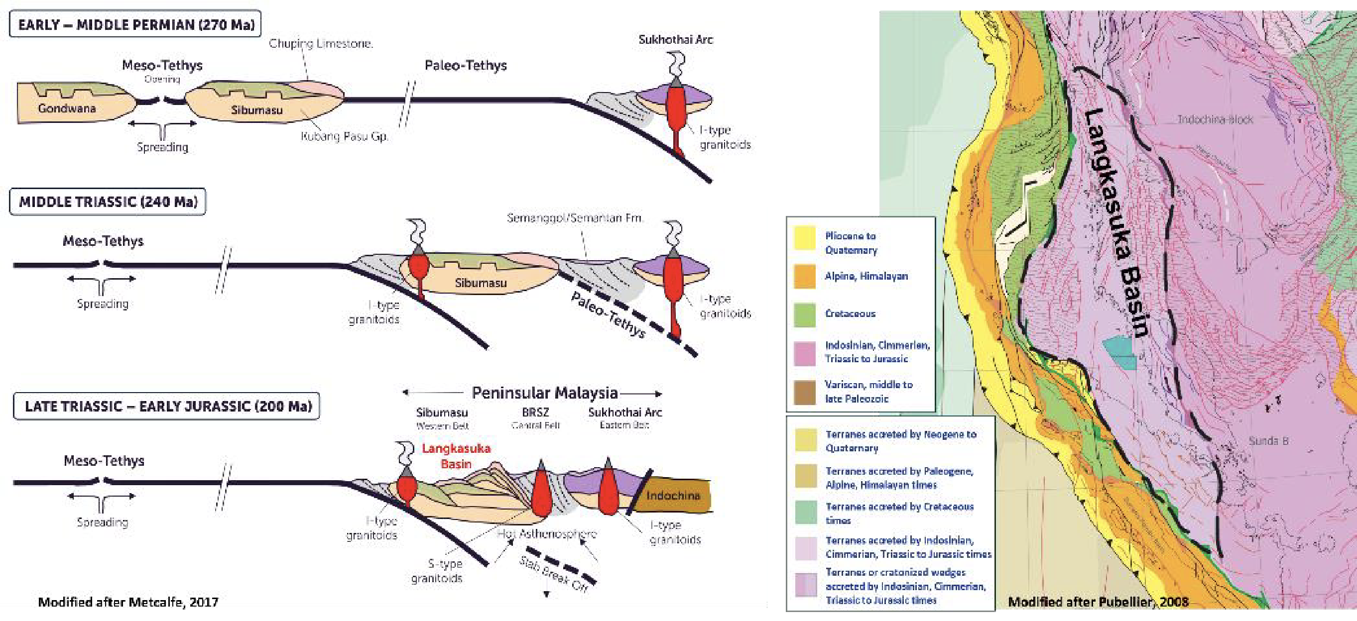
The Langkasuka Basin, located at the southernmost part of the Sibumasu terrain, was connected to the Gondwana supercontinent from the Paleozoic to Mesozoic. During Permian Period, the Sibumasu Terrane rifted, drifted, and subducted into the Indochina block, forming the Langkasuka Basin in the Late Triassic to Jurassic Period. This basin is emerging as a promising frontier, analogous to the Canning Basin in Northwest Australia. Exploration in the 1970s initially focused on the Tertiary level, yielding positive hydrocarbon indications. The discovery of Singa Besar-1 in the Permian prompted further exploration into the deeper Pre-Tertiary layers by PETRONAS.

The proposed schematic model suggests that the regional structural framework could potentially be due to the major thrusting event resulted from the Sibumasu-Indochina collision. The potential for repeat sections can be extended towards the offshore area, potentially unlocking opportunities in the Pre-Tertiary succession of the Langkasuka Basin.
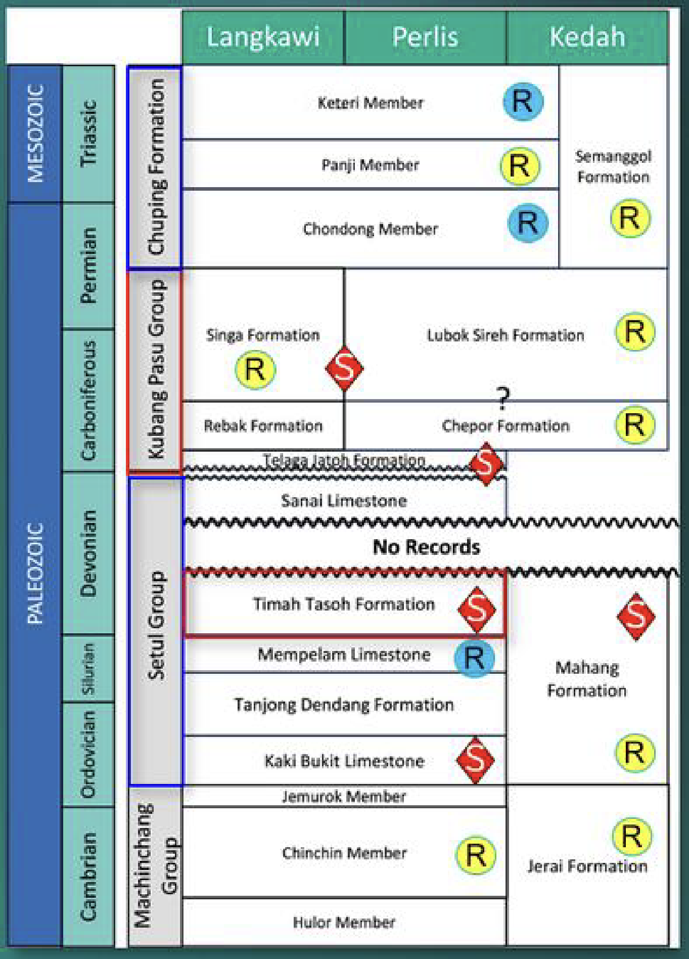
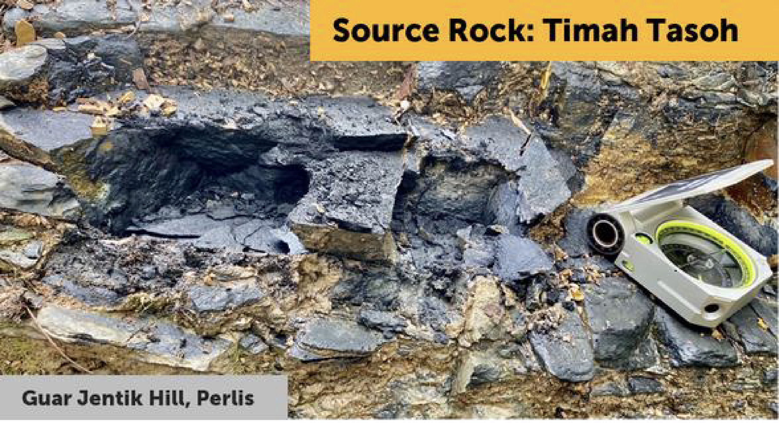
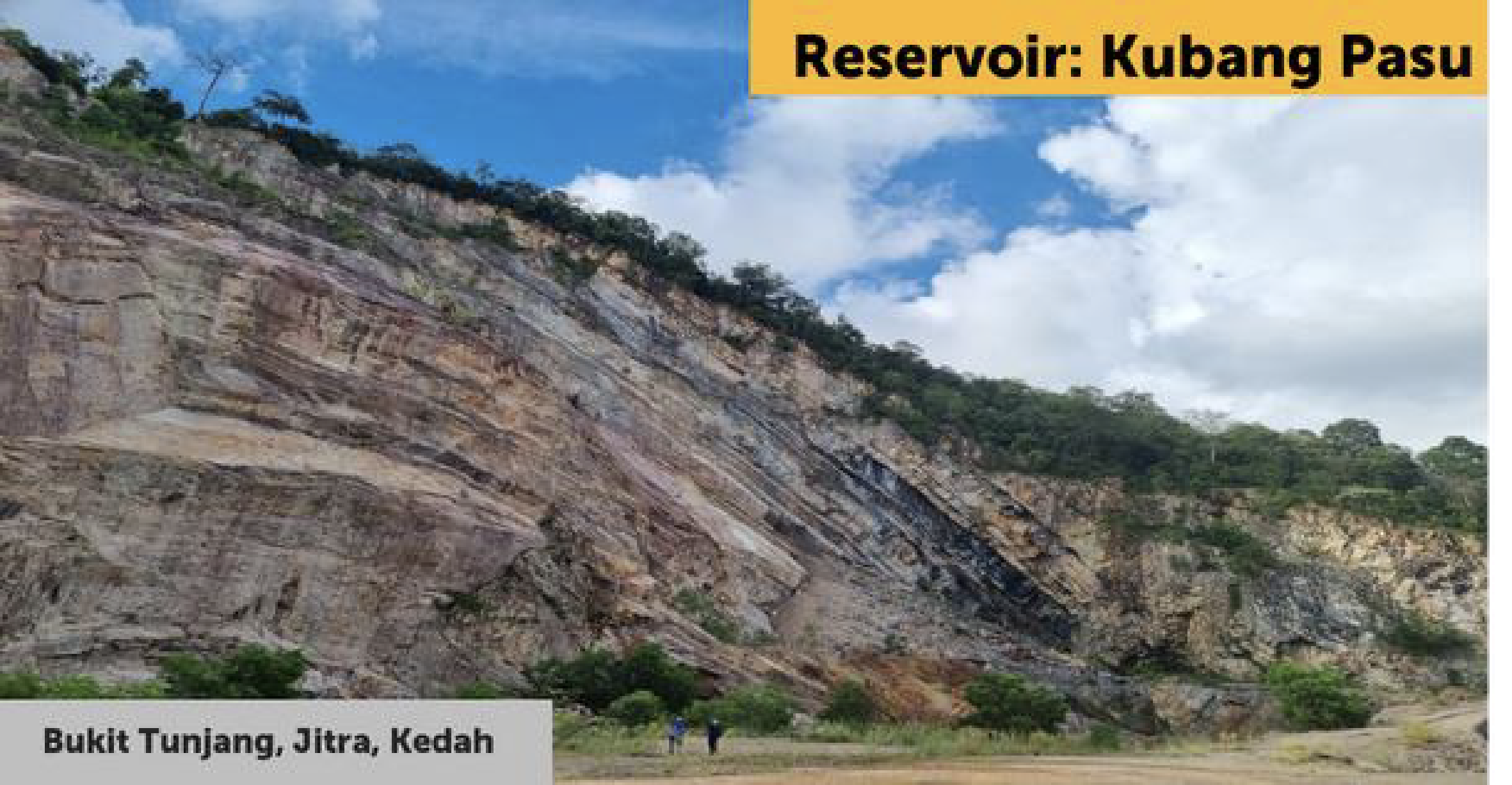
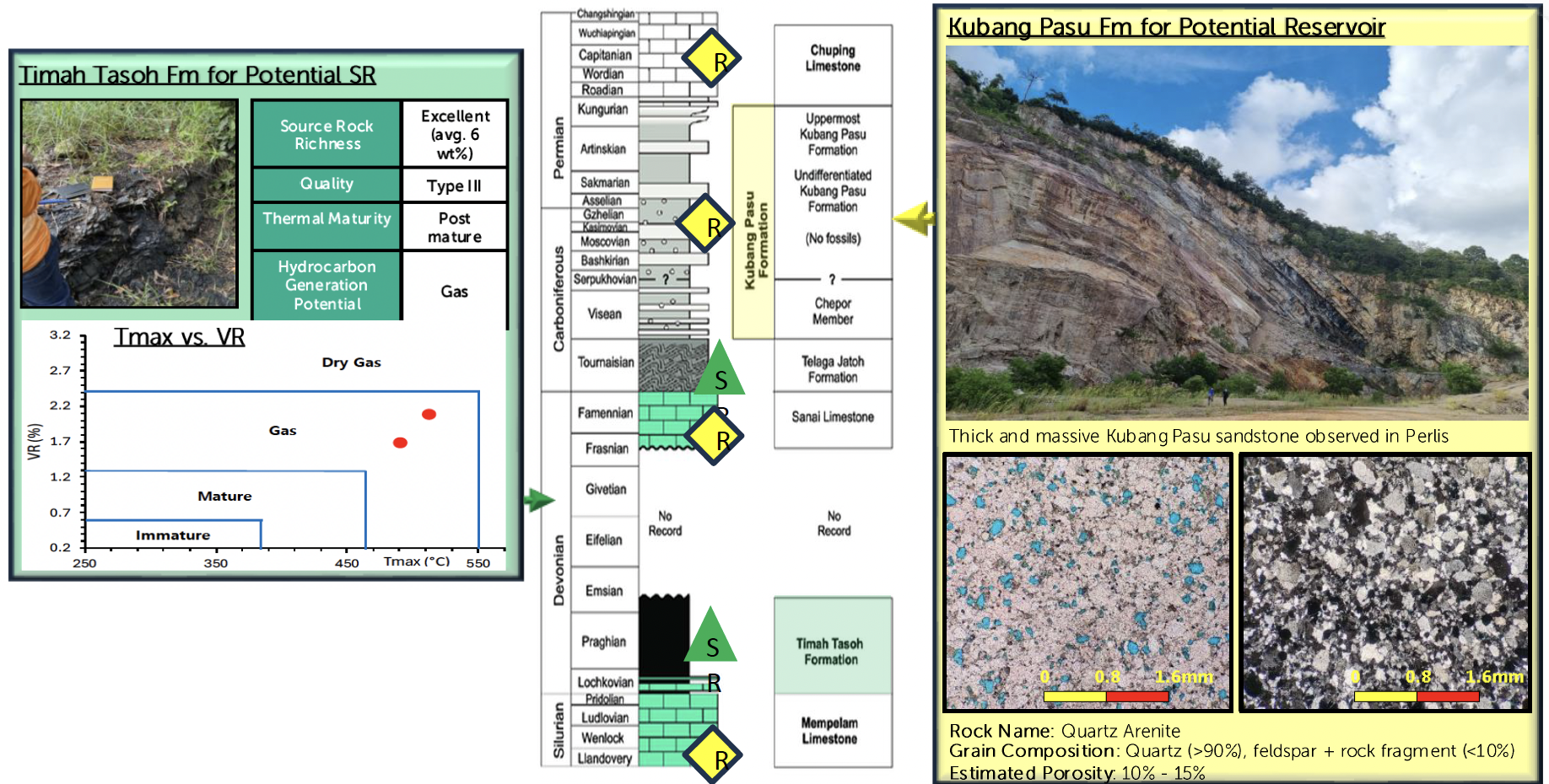
In Paleozoic stratigraphy onshore, the clastic and carbonate reservoirs of Kubang Pasu, Setul Limestone and Permian Chuping, are present together with multiple source rock intervals such as the black shales of the Devonian Timah Tasoh and the high TOC shales within the Kubang Pasu Group. In comparison with the proven gas discoveries in Paleozoic sedimentary sequence in Canning Basin, the prospect of Langkasuka Basin is expected to be present.
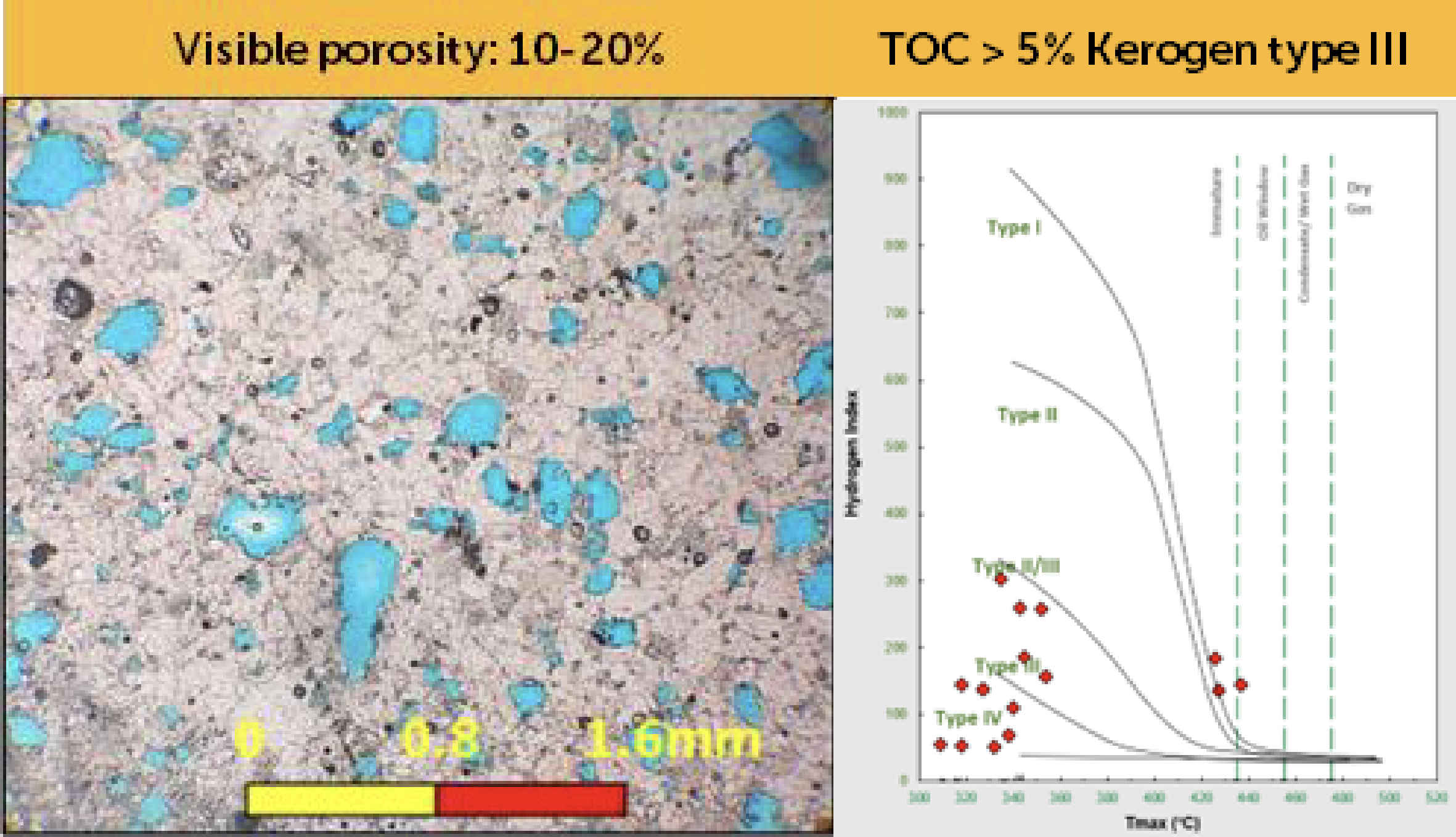
Geochemical analysis indicates fair to good source rock potential from Devonian to Carboniferous intervals, with TOC exceeding 5% indicating excellent quality Type III kerogen derived mainly from terrestrial plants. This source rock has the potential to generate hydrocarbons into potential reservoirs.
The main reservoirs are from Carboniferous to Triassic and potential Ordovician to Devonian reservoirs, such as;
- Carboniferous Permian Kubang Pasu clastics exhibit visual porosity up to 20%, likely deposited in shallow to deep marine environments.
- Permian limestone reservoirs, as proven in the Singa Besar well, flowed gas with an average porosity of 16%.
These source and reservoir successions are anticipated to extend offshore.
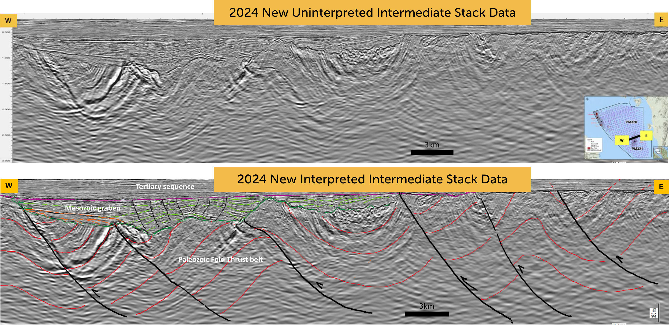
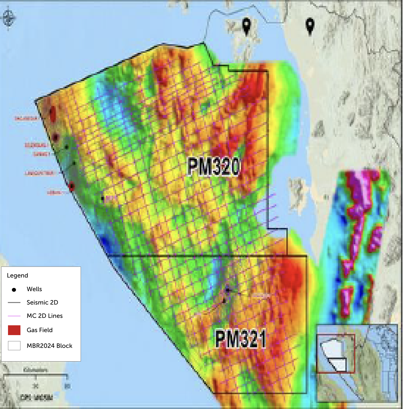
PETRONAS’ newly acquired Multi-Client 2D seismic data, employing low-frequency sources is aimed at improving the imaging of the deeper Pre Tertiary play. The intermediate stack data revealed the presence of Paleozoic fold-thrust belt structures, and Mesozoic grabens. This approach enhances seismic imaging, allowing for the identification of potential hydrocarbon traps.
Highlighting good source rock quality, proven reservoir presence and numerous potential traps, these factors signify the next investment opportunities. Given the frontier nature of the area, the Malaysia Bid Round (MBR) 2024 offers an attractive two-phase exploration opportunity for PM320 and PM321. This offering includes existing 2D seismic, newly acquired 2D seismic, and FTG data.
Field observations and lab analyses onshore Perlis indicated excellent Source Rock (SR) richness in Devonian Timah Tasoh Fm which exceeding 5%. This SR could potentially charge the younger clastic and/or carbonates in the offshore area. One of the potential reservoir is the Kubang Pasu sandstone which portray at least 50 m thick of massive sandstone in one of the outcrop. The petrography analyses indicated up to 15% porosity has been preserved within this section. The folded plunging anticline is a good analogue for the trapping mechanism in the vicinities.
In the context of seismic acquisition, using a low frequency source like Harmony in this challenging areas like Langkasuka Basin offers several benefits:
- Deeper Penetration: Harmony’s low frequency waves extend deeper, aiding in the imaging of deeper pre- Tertiary intervals.
- Better Resolution: Low frequency data enriches the frequency spectrum’s lower end, enhancing seismic image clarity.
- Optimized Source Configuration: Tailoring source arrays with low frequency sources targets geological complexities, improving imaging within Pre-Tertiary thrust structures.
- Enhanced SNR: Low frequency source boost the signal-to-noise ratio, providing clearer signals from deep sections.
Langkasuka Basin, with its importance and intricate geology, can greatly benefits from this advanced technology, enabling more efficient hydrocarbon exploration and assessment in its profound sections.
Subscribe to PETRONAS myPROdata to explore the MBR 2024 opportunities on offer:
https://www.petronas.com/myprodata/
Contact Details
Sharifah Shahira Wafa
Head of Business Development, Block Promotion and Marketing, Resource Exploration
Malaysia Petroleum Management
shahirawafa@petronas.com


